
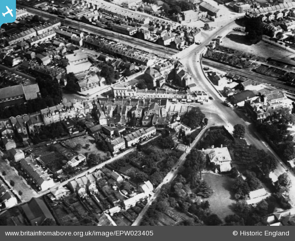
EPW023405 ENGLAND (1928). The Causeway and environs, Teddington, 1928. This image has been produced from a print.
© Copyright OpenStreetMap contributors and licensed by the OpenStreetMap Foundation. 2024. Cartography is licensed as CC BY-SA.
Nearby Images (5)
EPW023405

EPW023402

EPW023397

EPW023399

EPW053660

Details
| Title | [EPW023405] The Causeway and environs, Teddington, 1928. This image has been produced from a print. |
| Reference | EPW023405 |
| Date | September-1928 |
| Link | |
| Place name | TEDDINGTON |
| Parish | |
| District | |
| Country | ENGLAND |
| Easting / Northing | 515818, 170941 |
| Longitude / Latitude | -0.33397493465555, 51.425135937798 |
| National Grid Reference | TQ158709 |
Pins
Be the first to add a comment to this image!


