
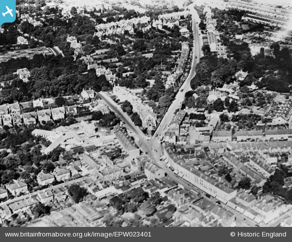
EPW023401 ENGLAND (1928). The junction of Broad Street, Hampton Road and Stanley Road, Teddington, 1928. This image has been produced from a copy-negative.
© Copyright OpenStreetMap contributors and licensed by the OpenStreetMap Foundation. 2024. Cartography is licensed as CC BY-SA.
Nearby Images (2)
EPW023401

EPW053660

Details
| Title | [EPW023401] The junction of Broad Street, Hampton Road and Stanley Road, Teddington, 1928. This image has been produced from a copy-negative. |
| Reference | EPW023401 |
| Date | September-1928 |
| Link | |
| Place name | TEDDINGTON |
| Parish | |
| District | |
| Country | ENGLAND |
| Easting / Northing | 515475, 171035 |
| Longitude / Latitude | -0.33887606462436, 51.426050893425 |
| National Grid Reference | TQ155710 |
Pins
 J M H |
Saturday 30th of April 2016 10:03:39 PM |


