
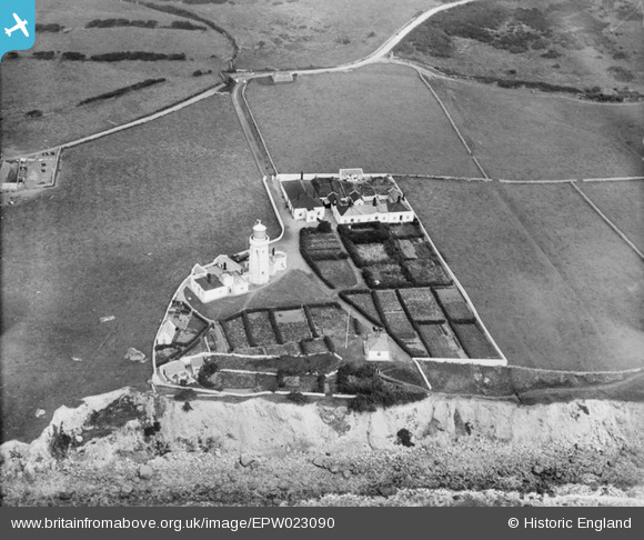
EPW023090 ENGLAND (1928). St. Catherine's Lighthouse, St Catherine's Point, 1928
© Copyright OpenStreetMap contributors and licensed by the OpenStreetMap Foundation. 2024. Cartography is licensed as CC BY-SA.
Nearby Images (9)
EPW023090

EPW000798

EAW038598

EPW023086

EPW023087

EPW000504

EPW039632

EAW038599

EPW000506

Details
| Title | [EPW023090] St. Catherine's Lighthouse, St Catherine's Point, 1928 |
| Reference | EPW023090 |
| Date | August-1928 |
| Link | |
| Place name | ST CATHERINE'S POINT |
| Parish | NITON AND WHITWELL |
| District | |
| Country | ENGLAND |
| Easting / Northing | 449834, 75351 |
| Longitude / Latitude | -1.2961427598117, 50.575182620091 |
| National Grid Reference | SZ498754 |
Pins
User Comment Contributions
This lighthouse dates from 1840. It was originally 120 ft high. Fog adversely affected the light and the tower was reduced in height in 1875. It is said to be the third most powerful light in the Trinity House estate |
 MB |
Monday 29th of October 2012 02:20:22 PM |


