
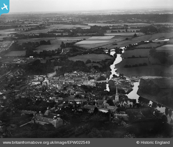
EPW022549 ENGLAND (1928). Abingdon Bridge and the town, Abingdon, from the south-west, 1928
© Copyright OpenStreetMap contributors and licensed by the OpenStreetMap Foundation. 2024. Cartography is licensed as CC BY-SA.
Nearby Images (7)
EPW022549

EPW022553

EPW000887

EPW000889

EPW000886

EPW000888

EPW022544

Details
| Title | [EPW022549] Abingdon Bridge and the town, Abingdon, from the south-west, 1928 |
| Reference | EPW022549 |
| Date | 11-August-1928 |
| Link | |
| Place name | ABINGDON |
| Parish | ABINGDON |
| District | |
| Country | ENGLAND |
| Easting / Northing | 449676, 196839 |
| Longitude / Latitude | -1.2816268238666, 51.667664664197 |
| National Grid Reference | SU497968 |
Pins
Be the first to add a comment to this image!
User Comment Contributions
Abingdon and Culham bridges and causeway were built in 1416 which made a more direct route from London to the west country and brought great prosperity to the Town. The Bridge was first widened in 1820.Then in 1928 there was a major reconstruction took place with total demolition of the main navigational Arch over the Thames. This was replaced with a more graceful arch, If you look all you can see is the Tempoary Wooden structure to cross. |
 Andy from Abingdon on Thames |
Tuesday 16th of October 2012 08:22:39 PM |


