
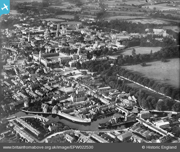
EPW022530 ENGLAND (1928). Christ Church and the city, Oxford, 1928
© Copyright OpenStreetMap contributors and licensed by the OpenStreetMap Foundation. 2024. Cartography is licensed as CC BY-SA.
Nearby Images (18)
EPW022530

EPW000843

EPW000829

EPW017839

EAW047927

EAW014894

EPW038406

EAW003127

EAW045713

EPW000832

EPW052774

EAW047925

EPW024627

EAW014893

EPW000824

EAW018727

EPW038408

EAW049087

Details
| Title | [EPW022530] Christ Church and the city, Oxford, 1928 |
| Reference | EPW022530 |
| Date | 11-August-1928 |
| Link | |
| Place name | OXFORD |
| Parish | |
| District | |
| Country | ENGLAND |
| Easting / Northing | 451501, 205831 |
| Longitude / Latitude | -1.2539086028417, 51.748351205085 |
| National Grid Reference | SP515058 |
Pins
 Alan McFaden |
Wednesday 17th of July 2013 01:29:51 PM | |
Alan McFaden |
Wednesday 17th of July 2013 01:28:35 PM | |
 Memory Lane |
Thursday 7th of March 2013 03:42:11 PM |


User Comment Contributions
 The Bridge of Sighs Oxford |
Alan McFaden |
Friday 5th of December 2014 01:34:32 PM |
 Christ Church Memorial Garden Oxford |
Alan McFaden |
Friday 5th of December 2014 01:34:04 PM |


