
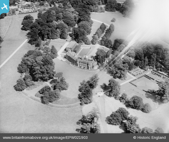
EPW021903 ENGLAND (1928). Esher Place, Esher, 1928
© Copyright OpenStreetMap contributors and licensed by the OpenStreetMap Foundation. 2024. Cartography is licensed as CC BY-SA.
Nearby Images (4)
EPW021903

EPW023458

EPW023454

EPW021911

Details
| Title | [EPW021903] Esher Place, Esher, 1928 |
| Reference | EPW021903 |
| Date | July-1928 |
| Link | |
| Place name | ESHER |
| Parish | |
| District | |
| Country | ENGLAND |
| Easting / Northing | 513364, 164909 |
| Longitude / Latitude | -0.3711872683598, 51.371410444092 |
| National Grid Reference | TQ134649 |
Pins
Be the first to add a comment to this image!


