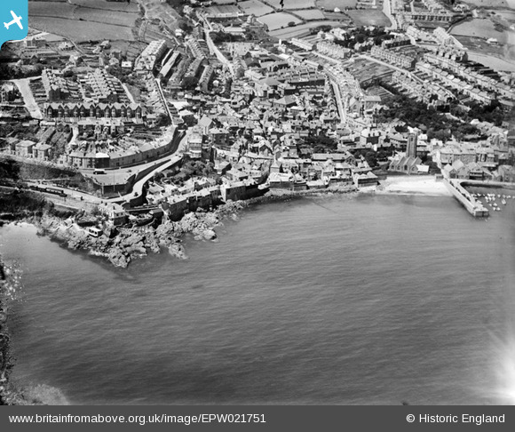
EPW021751 ENGLAND (1928). Pedn Olva and the town, St Ives, 1928
© Copyright OpenStreetMap contributors and licensed by the OpenStreetMap Foundation. 2024. Cartography is licensed as CC BY-SA.
Nearby Images (3)
EPW021751

EPW021746

EPW021749

Details
| Title | [EPW021751] Pedn Olva and the town, St Ives, 1928 |
| Reference | EPW021751 |
| Date | 24-June-1928 |
| Link | |
| Place name | ST IVES |
| Parish | ST. IVES |
| District | |
| Country | ENGLAND |
| Easting / Northing | 151912, 40411 |
| Longitude / Latitude | -5.4776312563839, 50.210987812225 |
| National Grid Reference | SW519404 |