
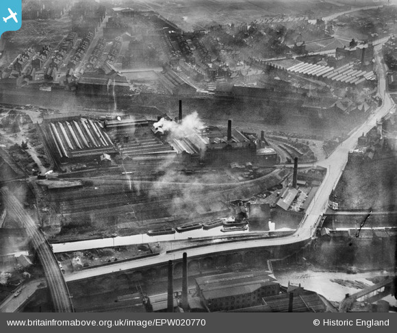
EPW020770 ENGLAND (1928). Wilsons and Mathiesons Scotch Foundry, Armley, 1928
© Copyright OpenStreetMap contributors and licensed by the OpenStreetMap Foundation. 2024. Cartography is licensed as CC BY-SA.
Nearby Images (24)
EPW020770

EPW020771

EPW020775

EPW020774

EPW020772

EPW022701

EPW020773

EPW022703

EPW022702

EPW017305

EPW017303

EPW017306

EPW017304

EPW017308

EPW022708

EPW022704

EPW022705

EPW022706

EPW017307

EPW022709

EAW035539

EAW035543

EAW035538

EAW035541

Details
| Title | [EPW020770] Wilsons and Mathiesons Scotch Foundry, Armley, 1928 |
| Reference | EPW020770 |
| Date | 11-April-1928 |
| Link | |
| Place name | ARMLEY |
| Parish | |
| District | |
| Country | ENGLAND |
| Easting / Northing | 427773, 433958 |
| Longitude / Latitude | -1.5782723093748, 53.800967048633 |
| National Grid Reference | SE278340 |
Pins
Be the first to add a comment to this image!


