
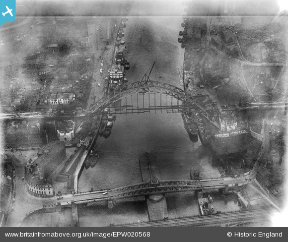
EPW020568 ENGLAND (1928). The Tyne Bridge under construction and the Newcastle Swing Bridge, Newcastle Upon Tyne, 1928
© Copyright OpenStreetMap contributors and licensed by the OpenStreetMap Foundation. 2024. Cartography is licensed as CC BY-SA.
Nearby Images (21)
EPW020568

EPW025016

EPW054561

EPW048345

EPW048229

EPW019820

EPW054559

EPW020570

EPW048805

EPW048346

EPW020569

EPW048235

EPW025015

EPW048799

EPW048263

EPW010393

EPW048230

EPW048800

EPW048803

EAW405203

EPW019832

Details
| Title | [EPW020568] The Tyne Bridge under construction and the Newcastle Swing Bridge, Newcastle Upon Tyne, 1928 |
| Reference | EPW020568 |
| Date | March-1928 |
| Link | |
| Place name | NEWCASTLE UPON TYNE |
| Parish | |
| District | |
| Country | ENGLAND |
| Easting / Northing | 425316, 563783 |
| Longitude / Latitude | -1.6045187485161, 54.967950081339 |
| National Grid Reference | NZ253638 |
Pins
Be the first to add a comment to this image!


