
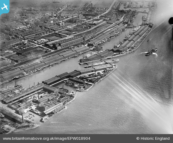
EPW018904 ENGLAND (1927). Brunswick and Toxteth Docks, Toxteth, 1927
© Copyright OpenStreetMap contributors and licensed by the OpenStreetMap Foundation. 2024. Cartography is licensed as CC BY-SA.
Nearby Images (5)
EPW018904

EPR000321

EAW399274

EPW050659

EPW050660

Details
| Title | [EPW018904] Brunswick and Toxteth Docks, Toxteth, 1927 |
| Reference | EPW018904 |
| Date | 17-July-1927 |
| Link | |
| Place name | TOXTETH |
| Parish | |
| District | |
| Country | ENGLAND |
| Easting / Northing | 334661, 388269 |
| Longitude / Latitude | -2.9825194710505, 53.386952969472 |
| National Grid Reference | SJ347883 |
Pins
 austin |
Saturday 22nd of October 2022 07:51:08 PM | |
BONZO |
Saturday 2nd of August 2014 06:24:12 PM | |
Pete65 |
Saturday 2nd of November 2013 08:26:45 PM | |
Pete65 |
Saturday 2nd of November 2013 08:25:49 PM |


