
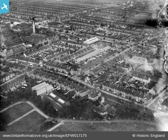
EPW017175 ENGLAND (1926). High Street South and the area around Market Street, East Ham, 1926
© Copyright OpenStreetMap contributors and licensed by the OpenStreetMap Foundation. 2024. Cartography is licensed as CC BY-SA.
Nearby Images (5)
EPW017175

EPW017176

EPW017174

EPW016614

EPW016613

Details
| Title | [EPW017175] High Street South and the area around Market Street, East Ham, 1926 |
| Reference | EPW017175 |
| Date | October-1926 |
| Link | |
| Place name | EAST HAM |
| Parish | |
| District | |
| Country | ENGLAND |
| Easting / Northing | 542742, 183334 |
| Longitude / Latitude | 0.058088686424027, 51.530366746138 |
| National Grid Reference | TQ427833 |
Pins
Be the first to add a comment to this image!


