
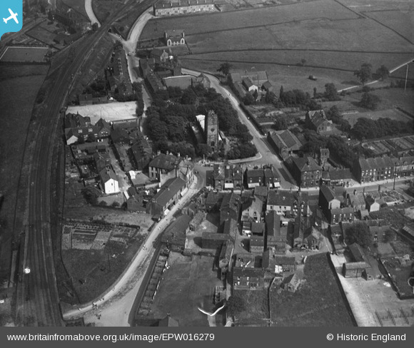
EPW016279 ENGLAND (1926). St John the Baptist's Church and the Market Place, Penistone, 1926
© Copyright OpenStreetMap contributors and licensed by the OpenStreetMap Foundation. 2024. Cartography is licensed as CC BY-SA.
Nearby Images (4)
EPW016279

EPW016278

EPW016276

EAW043359

Details
| Title | [EPW016279] St John the Baptist's Church and the Market Place, Penistone, 1926 |
| Reference | EPW016279 |
| Date | 14-July-1926 |
| Link | |
| Place name | PENISTONE |
| Parish | PENISTONE |
| District | |
| Country | ENGLAND |
| Easting / Northing | 424621, 403320 |
| Longitude / Latitude | -1.6285631589797, 53.525720036208 |
| National Grid Reference | SE246033 |
Pins
 Rob Daniels |
Friday 8th of April 2022 09:58:36 PM |


