
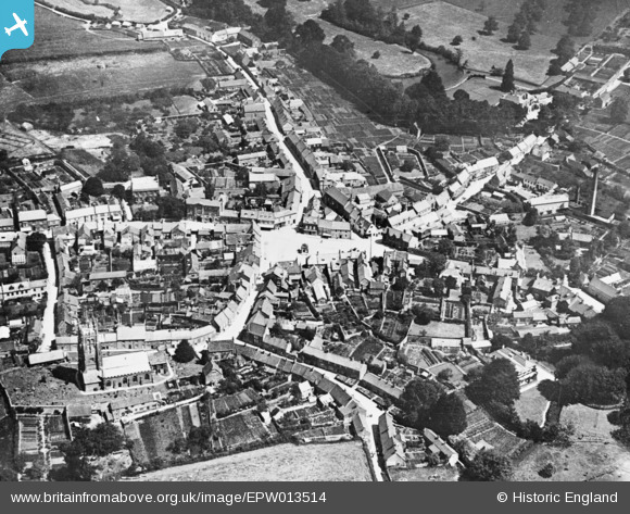
EPW013514 ENGLAND (1925). The Square and town centre, Beaminster, 1925. This image has been produced from a copy-negative.
© Copyright OpenStreetMap contributors and licensed by the OpenStreetMap Foundation. 2024. Cartography is licensed as CC BY-SA.
Nearby Images (17)
EPW013514

EPW024036

EPW013512

EPW024031

EPW054802

EPW013513

EPW024038

EPW054803

EPW024033

EPW024035

EPW024034

EPW054801

EPW054799

EPW054796

EPW054798

EPW054800

EPW024039

Details
| Title | [EPW013514] The Square and town centre, Beaminster, 1925. This image has been produced from a copy-negative. |
| Reference | EPW013514 |
| Date | June-1925 |
| Link | |
| Place name | BEAMINSTER |
| Parish | BEAMINSTER |
| District | |
| Country | ENGLAND |
| Easting / Northing | 348034, 101314 |
| Longitude / Latitude | -2.7376197544882, 50.808482303869 |
| National Grid Reference | ST480013 |
Pins
Be the first to add a comment to this image!


