
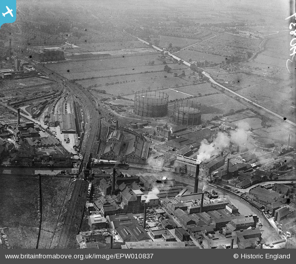
EPW010837 ENGLAND (1924). The Gas Works and the Ultramarine and Black Lead Works, Kingston upon Hull, 1924
© Copyright OpenStreetMap contributors and licensed by the OpenStreetMap Foundation. 2024. Cartography is licensed as CC BY-SA.
Nearby Images (12)
EPW010837

EPW010838

EPW042073

EPW036532

EPW042072

EPW036525

EPW042074

EPW036510

EPW042078

EPW042075

EAW015647

EPW036522

Details
| Title | [EPW010837] The Gas Works and the Ultramarine and Black Lead Works, Kingston upon Hull, 1924 |
| Reference | EPW010837 |
| Date | June-1924 |
| Link | |
| Place name | KINGSTON UPON HULL |
| Parish | |
| District | |
| Country | ENGLAND |
| Easting / Northing | 509750, 431102 |
| Longitude / Latitude | -0.33484681262201, 53.764471318018 |
| National Grid Reference | TA098311 |
Pins
Be the first to add a comment to this image!


