
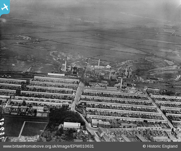
EPW010631 ENGLAND (1924). The Ashington Colliery and surrounding housing terraces, Ashington, 1924
© Copyright OpenStreetMap contributors and licensed by the OpenStreetMap Foundation. 2024. Cartography is licensed as CC BY-SA.
Nearby Images (5)
EPW010631

EPW010629

EPW010633

EPW010630

EPW010632

Details
| Title | [EPW010631] The Ashington Colliery and surrounding housing terraces, Ashington, 1924 |
| Reference | EPW010631 |
| Date | 14-June-1924 |
| Link | |
| Place name | ASHINGTON |
| Parish | ASHINGTON |
| District | |
| Country | ENGLAND |
| Easting / Northing | 426442, 588113 |
| Longitude / Latitude | -1.5846701361311, 55.186542158643 |
| National Grid Reference | NZ264881 |
Pins
 Rob McGinley |
Sunday 28th of June 2015 08:15:12 PM |


