
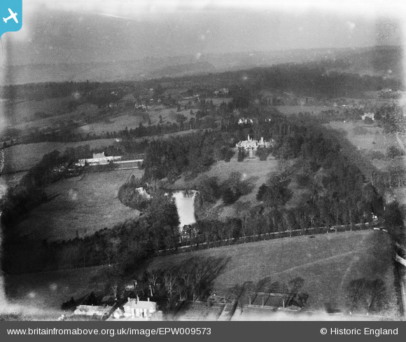
EPW009573 ENGLAND (1923). Harrow Weald Park, Harrow Weald, from the south, 1923
© Copyright OpenStreetMap contributors and licensed by the OpenStreetMap Foundation. 2024. Cartography is licensed as CC BY-SA.
Nearby Images (4)
EPW009573

EPW009571

EPW009574

EPW035061

Details
| Title | [EPW009573] Harrow Weald Park, Harrow Weald, from the south, 1923 |
| Reference | EPW009573 |
| Date | 1923 |
| Link | |
| Place name | HARROW WEALD |
| Parish | |
| District | |
| Country | ENGLAND |
| Easting / Northing | 514909, 191503 |
| Longitude / Latitude | -0.34033916289467, 51.610147046188 |
| National Grid Reference | TQ149915 |
Pins
 Graham |
Sunday 30th of October 2022 11:11:01 PM | |
 czyrko |
Thursday 26th of August 2021 01:53:56 PM | |
czyrko |
Saturday 26th of April 2014 10:00:15 PM | |
My Great Grandfather John George lived there in the late Victorian period. He was a labourer at the brickworks on Clamp Hill. Died 1901 |
OldBill |
Friday 24th of March 2017 06:51:51 PM |
czyrko |
Saturday 26th of April 2014 09:58:53 PM | |
czyrko |
Saturday 26th of April 2014 09:58:04 PM | |
czyrko |
Saturday 26th of April 2014 09:57:08 PM | |
czyrko |
Saturday 26th of April 2014 09:56:32 PM | |
czyrko |
Saturday 26th of April 2014 09:55:46 PM | |
I'm pretty certain that this is Kiln House, just north of The Hare. Grimsdyke Manor was North West of 'The City' so would have been well to the left. |
Herga |
Friday 12th of June 2015 01:49:27 AM |


