
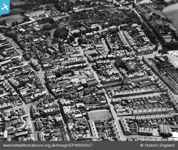
EPW009217 ENGLAND (1923). Tufton Street and environs, Ashford, 1923
© Copyright OpenStreetMap contributors and licensed by the OpenStreetMap Foundation. 2024. Cartography is licensed as CC BY-SA.
Nearby Images (15)
EPW009217

EPW001440

EPW007035

EPW026091

EPW026096

EPW009218

EPW026086

EPW009142

EPW026100

EAW026215

EPW000710

EAW013658

EPW026089

EPW041207

EPW026088

Details
| Title | [EPW009217] Tufton Street and environs, Ashford, 1923 |
| Reference | EPW009217 |
| Date | 1923 |
| Link | |
| Place name | ASHFORD |
| Parish | |
| District | |
| Country | ENGLAND |
| Easting / Northing | 600875, 142751 |
| Longitude / Latitude | 0.87239586207777, 51.148191189369 |
| National Grid Reference | TR009428 |
Pins
Be the first to add a comment to this image!


