
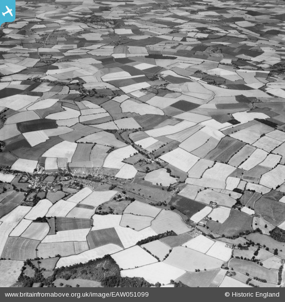
EAW051099 ENGLAND (1953). Garland's Farm, the village and the surrounding countryside, Steeple Bumpstead, 1953
© Copyright OpenStreetMap contributors and licensed by the OpenStreetMap Foundation. 2024. Cartography is licensed as CC BY-SA.
Nearby Images (5)
EAW051099

EAW051103

EAW051101

EAW051102

EAW051097

Details
| Title | [EAW051099] Garland's Farm, the village and the surrounding countryside, Steeple Bumpstead, 1953 |
| Reference | EAW051099 |
| Date | 10-August-1953 |
| Link | |
| Place name | STEEPLE BUMPSTEAD |
| Parish | STEEPLE BUMPSTEAD |
| District | |
| Country | ENGLAND |
| Easting / Northing | 567780, 242201 |
| Longitude / Latitude | 0.44724252718915, 52.052340140383 |
| National Grid Reference | TL678422 |
Pins
 Matt Aldred edob.mattaldred.com |
Sunday 12th of April 2020 12:15:05 PM | |
 Graham Yaxley |
Monday 26th of January 2015 06:26:27 PM |


