
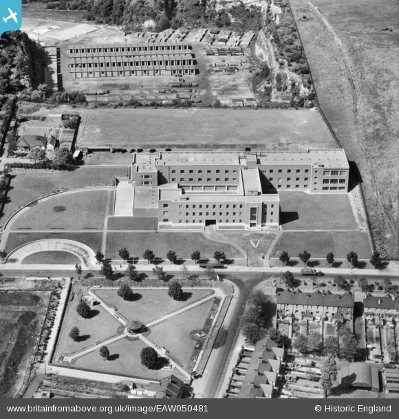
EAW050481 ENGLAND (1953). Office building on London Road, Purfleet, 1953
© Copyright OpenStreetMap contributors and licensed by the OpenStreetMap Foundation. 2024. Cartography is licensed as CC BY-SA.
Nearby Images (24)
EAW050481

EAW050476

EAW050480

EAW050473

EAW050477

EAW050475

EAW050479

EAW010056

EAW050478

EAW050474

EAW010066

EAW010055

EAW010057

EAW010067

EAW011782

EAW011776

EAW011778

EAW010065

EAW011777

EAW030557

EAW030548

EPW026351

EAW010064

EAW030558

Details
| Title | [EAW050481] Office building on London Road, Purfleet, 1953 |
| Reference | EAW050481 |
| Date | 8-July-1953 |
| Link | |
| Place name | PURFLEET |
| Parish | |
| District | |
| Country | ENGLAND |
| Easting / Northing | 555929, 178022 |
| Longitude / Latitude | 0.24572267829519, 51.479147327286 |
| National Grid Reference | TQ559780 |
Pins
Be the first to add a comment to this image!


