
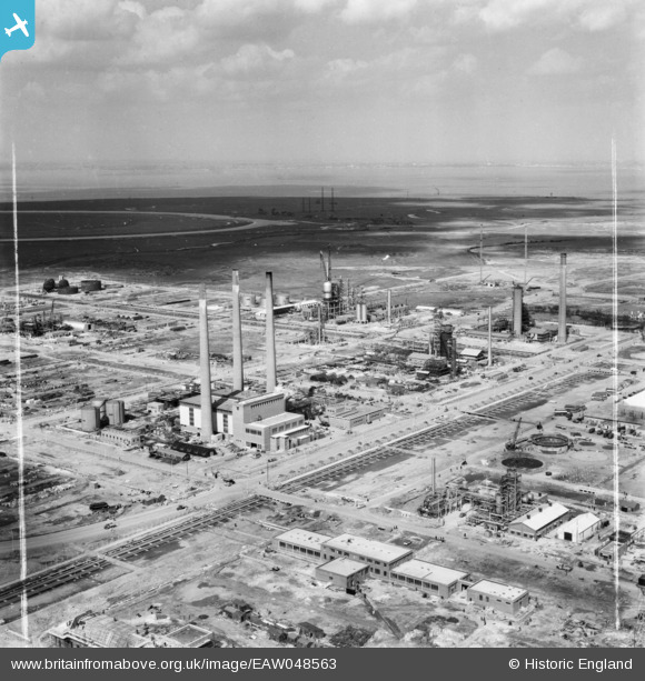
EAW048563 ENGLAND (1953). The Anglo-Iranian Oil Co Ltd Kent Oil Refinery under construction, Isle of Grain, from the south, 1953. This image was marked by Aerofilms Ltd for photo editing.
© Copyright OpenStreetMap contributors and licensed by the OpenStreetMap Foundation. 2024. Cartography is licensed as CC BY-SA.
Nearby Images (22)
EAW048563

EAW048518

EAW048566

EAW045780

EAW048562

EAW048525

EAW045771

EAW048561

EAW034851

EAW034852

EAW048513

EAW045764

EAW045768

EAW048519

EAW045763

EAW045770

EAW048514

EAW048527

EAW048522

EAW048516

EAW048517

EAW039859

Details
| Title | [EAW048563] The Anglo-Iranian Oil Co Ltd Kent Oil Refinery under construction, Isle of Grain, from the south, 1953. This image was marked by Aerofilms Ltd for photo editing. |
| Reference | EAW048563 |
| Date | 31-March-1953 |
| Link | |
| Place name | ISLE OF GRAIN |
| Parish | ISLE OF GRAIN |
| District | |
| Country | ENGLAND |
| Easting / Northing | 587074, 175130 |
| Longitude / Latitude | 0.69226108428872, 51.443727618965 |
| National Grid Reference | TQ871751 |


