
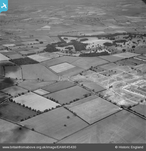
EAW045430 ENGLAND (1952). The junction of Cottingham Road and Uppingham Road and Rockingham Park, Corby, 1952
© Copyright OpenStreetMap contributors and licensed by the OpenStreetMap Foundation. 2024. Cartography is licensed as CC BY-SA.
Nearby Images (6)
EAW045430

EAW045568

EAW044684

EAW044688

EAW044692

EAW044691

Details
| Title | [EAW045430] The junction of Cottingham Road and Uppingham Road and Rockingham Park, Corby, 1952 |
| Reference | EAW045430 |
| Date | 6-August-1952 |
| Link | |
| Place name | CORBY |
| Parish | |
| District | |
| Country | ENGLAND |
| Easting / Northing | 486376, 289219 |
| Longitude / Latitude | -0.72761018692876, 52.493665221815 |
| National Grid Reference | SP864892 |
Pins
Be the first to add a comment to this image!


