
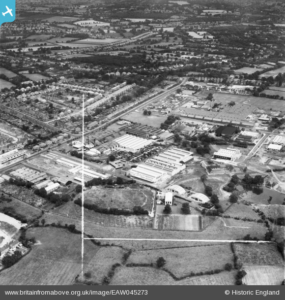
EAW045273 ENGLAND (1952). The Carco Protective Paper Packings Mill and Cranmore Mills, Cranmore Boulevard and environs, Shirley, 1952. This image was marked by Aerofilms Ltd for photo editing.
© Copyright OpenStreetMap contributors and licensed by the OpenStreetMap Foundation. 2024. Cartography is licensed as CC BY-SA.
Nearby Images (15)
EAW045273

EAW045275

EAW045271

EAW045276

EAW045277

EAW045274

EAW045278

EAW045272

EAW038065

EAW038071

EAW038061

EAW038063

EAW038064

EAW038066

EAW038062

Details
| Title | [EAW045273] The Carco Protective Paper Packings Mill and Cranmore Mills, Cranmore Boulevard and environs, Shirley, 1952. This image was marked by Aerofilms Ltd for photo editing. |
| Reference | EAW045273 |
| Date | 31-July-1952 |
| Link | |
| Place name | SHIRLEY |
| Parish | |
| District | |
| Country | ENGLAND |
| Easting / Northing | 413126, 277705 |
| Longitude / Latitude | -1.8070707113532, 52.396825936317 |
| National Grid Reference | SP131777 |
Pins
 BSA Alan |
Sunday 23rd of December 2018 01:09:07 AM |


