
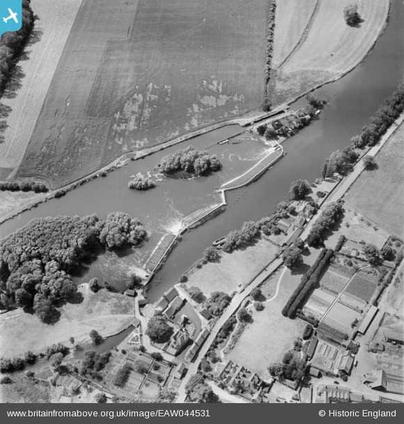
EAW044531 ENGLAND (1952). Hambleden Lock and Weir, Mill End, 1952
© Copyright OpenStreetMap contributors and licensed by the OpenStreetMap Foundation. 2024. Cartography is licensed as CC BY-SA.
Nearby Images (7)
EAW044531

EAW044563

EPW035842

EPW035843

EPW035841

EPW052743

EAW044566

Details
| Title | [EAW044531] Hambleden Lock and Weir, Mill End, 1952 |
| Reference | EAW044531 |
| Date | 4-July-1952 |
| Link | |
| Place name | MILL END |
| Parish | HAMBLEDEN |
| District | |
| Country | ENGLAND |
| Easting / Northing | 478325, 185079 |
| Longitude / Latitude | -0.87002848744141, 51.558671420873 |
| National Grid Reference | SU783851 |
Pins
 John W |
Sunday 17th of July 2016 05:36:38 PM |


