
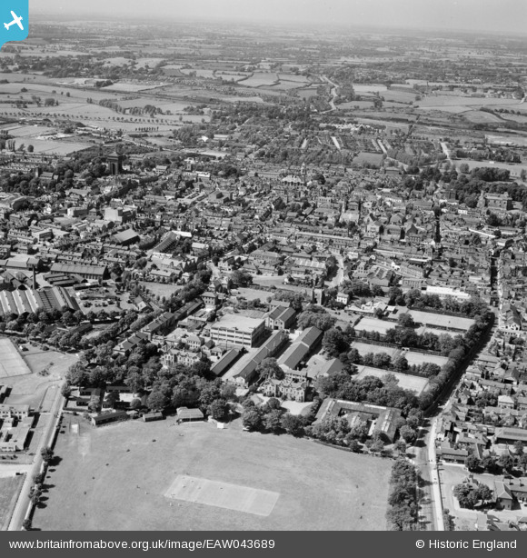
EAW043689 ENGLAND (1952). The site of the Benedictine Abbey of St John and the town, Colchester, from the south, 1952
© Copyright OpenStreetMap contributors and licensed by the OpenStreetMap Foundation. 2024. Cartography is licensed as CC BY-SA.
Nearby Images (5)
EAW043689

EAW043690

EPW001859

EPW018554

EAW024676

Details
| Title | [EAW043689] The site of the Benedictine Abbey of St John and the town, Colchester, from the south, 1952 |
| Reference | EAW043689 |
| Date | 4-June-1952 |
| Link | |
| Place name | COLCHESTER |
| Parish | |
| District | |
| Country | ENGLAND |
| Easting / Northing | 599780, 224548 |
| Longitude / Latitude | 0.90312666494025, 51.883202717571 |
| National Grid Reference | TL998245 |


