
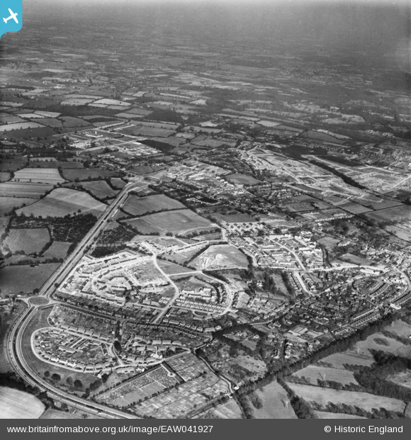
EAW041927 ENGLAND (1952). Crawley by-pass and the construction of new neighbourhoods at West Green and Northgate, West Green, from the south-west, 1952
© Copyright OpenStreetMap contributors and licensed by the OpenStreetMap Foundation. 2024. Cartography is licensed as CC BY-SA.
Nearby Images (3)
EAW041927

EAW037051

EAW041929

Details
| Title | [EAW041927] Crawley by-pass and the construction of new neighbourhoods at West Green and Northgate, West Green, from the south-west, 1952 |
| Reference | EAW041927 |
| Date | 14-March-1952 |
| Link | |
| Place name | WEST GREEN |
| Parish | |
| District | |
| Country | ENGLAND |
| Easting / Northing | 525898, 136781 |
| Longitude / Latitude | -0.20108280283122, 51.115942466649 |
| National Grid Reference | TQ259368 |
Pins
 Class31 |
Wednesday 30th of July 2014 07:24:06 PM | |
Class31 |
Wednesday 30th of July 2014 07:21:33 PM | |
Class31 |
Wednesday 30th of July 2014 07:20:51 PM | |
Class31 |
Wednesday 30th of July 2014 07:16:56 PM | |
Class31 |
Wednesday 30th of July 2014 07:16:37 PM | |
Class31 |
Wednesday 30th of July 2014 07:16:14 PM |


