
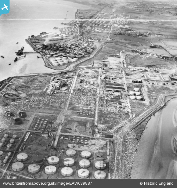
EAW039887 ENGLAND (1951). The Coryton Oil Refinery, Coryton, from the east, 1951. This image has been produced from a damaged negative.
© Copyright OpenStreetMap contributors and licensed by the OpenStreetMap Foundation. 2024. Cartography is licensed as CC BY-SA.
Nearby Images (26)
EAW039887

EPW044783

EAW045738

EPW044786

EAW034405

EAW034432

EAW048370

EAW048301

EAW048369

EAW048098

EAW048377

EAW035773

EAW039888

EAW043888

EAW048300

EPW044784

EPW044785

EAW034408

EAW045736

EAW039895

EAW034433

EAW045735

EAW048360

EAW048596

EAW042283

EAW043881

Details
| Title | [EAW039887] The Coryton Oil Refinery, Coryton, from the east, 1951. This image has been produced from a damaged negative. |
| Reference | EAW039887 |
| Date | 20-August-1951 |
| Link | |
| Place name | CORYTON |
| Parish | |
| District | |
| Country | ENGLAND |
| Easting / Northing | 575541, 182304 |
| Longitude / Latitude | 0.53002966957154, 51.511869601114 |
| National Grid Reference | TQ755823 |
Pins
 Tokyo |
Sunday 31st of January 2016 08:21:21 PM |


