
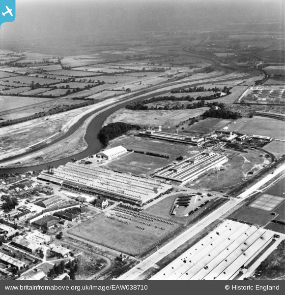
EAW038710 ENGLAND (1951). The International Harvester Factory off Wheatley Hall Road and environs, Doncaster, from the south-west, 1951. This image has been produced from a print.
© Copyright OpenStreetMap contributors and licensed by the OpenStreetMap Foundation. 2024. Cartography is licensed as CC BY-SA.
Nearby Images (16)
EAW038710

EAW038712

EAW038717

EAW027266

EAW038718

EAW038713

EAW038709

EAW038708

EAW038714

EAW027263

EAW038716

EAW027261

EAW027262

EAW027268

EAW027260

EAW027264

Details
| Title | [EAW038710] The International Harvester Factory off Wheatley Hall Road and environs, Doncaster, from the south-west, 1951. This image has been produced from a print. |
| Reference | EAW038710 |
| Date | 14-August-1951 |
| Link | |
| Place name | DONCASTER |
| Parish | |
| District | |
| Country | ENGLAND |
| Easting / Northing | 459290, 405518 |
| Longitude / Latitude | -1.1051734806232, 53.542708063433 |
| National Grid Reference | SE593055 |


