
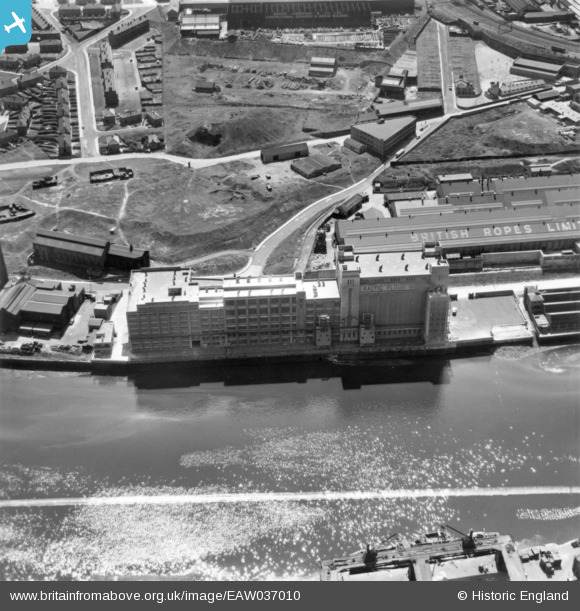
EAW037010 ENGLAND (1951). The Baltic Flour Mills, Gateshead, 1951. This image has been produced from a print marked by Aerofilms Ltd for photo editing.
© Copyright OpenStreetMap contributors and licensed by the OpenStreetMap Foundation. 2024. Cartography is licensed as CC BY-SA.
Nearby Images (20)
EAW037010

EAW037009

EAW037013

EAW037011

EAW037018

EAW037017

EAW037012

EPW048232

EAW037008

EAW037016

EAW037014

EPW048233

EPW048818

EPW051084

EAW037015

EPW051085

EPW051087

EPW051089

EPW048807

EPW048234

Details
| Title | [EAW037010] The Baltic Flour Mills, Gateshead, 1951. This image has been produced from a print marked by Aerofilms Ltd for photo editing. |
| Reference | EAW037010 |
| Date | 6-June-1951 |
| Link | |
| Place name | GATESHEAD |
| Parish | |
| District | |
| Country | ENGLAND |
| Easting / Northing | 425912, 563952 |
| Longitude / Latitude | -1.5951931438056, 54.969438261077 |
| National Grid Reference | NZ259640 |
Pins
Be the first to add a comment to this image!


