
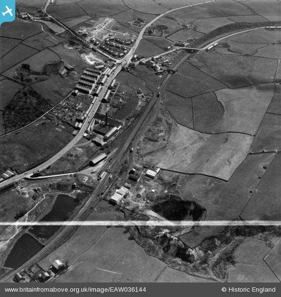
EAW036144 ENGLAND (1951). Blackburn Road, Hope Mill and environs, Rising Bridge, 1951. This image has been produced from a print marked by Aerofilms Ltd for photo editing.
© Copyright OpenStreetMap contributors and licensed by the OpenStreetMap Foundation. 2024. Cartography is licensed as CC BY-SA.
Nearby Images (8)
EAW036144

EAW036146

EAW036139

EAW036142

EAW036143

EAW036140

EAW036145

EAW036141

Details
| Title | [EAW036144] Blackburn Road, Hope Mill and environs, Rising Bridge, 1951. This image has been produced from a print marked by Aerofilms Ltd for photo editing. |
| Reference | EAW036144 |
| Date | 17-May-1951 |
| Link | |
| Place name | RISING BRIDGE |
| Parish | |
| District | |
| Country | ENGLAND |
| Easting / Northing | 377812, 425572 |
| Longitude / Latitude | -2.3363194564185, 53.725854265509 |
| National Grid Reference | SD778256 |
Pins
 wadey |
Thursday 16th of April 2015 04:14:20 PM | |
wadey |
Thursday 16th of April 2015 04:12:57 PM | |
wadey |
Thursday 16th of April 2015 04:11:22 PM | |
wadey |
Thursday 16th of April 2015 04:11:00 PM | |
wadey |
Thursday 16th of April 2015 04:10:24 PM | |
wadey |
Thursday 16th of April 2015 04:02:10 PM | |
wadey |
Thursday 16th of April 2015 04:01:35 PM | |
wadey |
Thursday 16th of April 2015 04:00:37 PM |


