
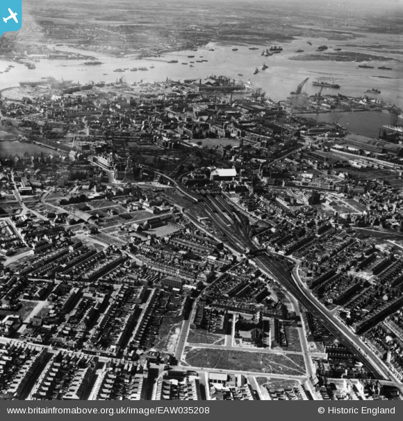
EAW035208 ENGLAND (1951). The city centre, Portsmouth, 1951. This image has been produced from a print.
© Copyright OpenStreetMap contributors and licensed by the OpenStreetMap Foundation. 2024. Cartography is licensed as CC BY-SA.
Nearby Images (7)
EAW035208

EAW035213

EAW405019

EAW035209

EAW035211

EAW037866

EAW037867

Details
| Title | [EAW035208] The city centre, Portsmouth, 1951. This image has been produced from a print. |
| Reference | EAW035208 |
| Date | 6-April-1951 |
| Link | |
| Place name | PORTSMOUTH |
| Parish | |
| District | |
| Country | ENGLAND |
| Easting / Northing | 464239, 100244 |
| Longitude / Latitude | -1.0883824578463, 50.797629080773 |
| National Grid Reference | SU642002 |
Pins
 John Wass |
Saturday 25th of July 2015 09:16:15 PM | |
John Wass |
Saturday 25th of July 2015 09:15:27 PM | |
John Wass |
Saturday 25th of July 2015 09:14:03 PM | |
John Wass |
Saturday 25th of July 2015 09:10:01 PM | |
John Wass |
Saturday 25th of July 2015 09:04:55 PM |


