
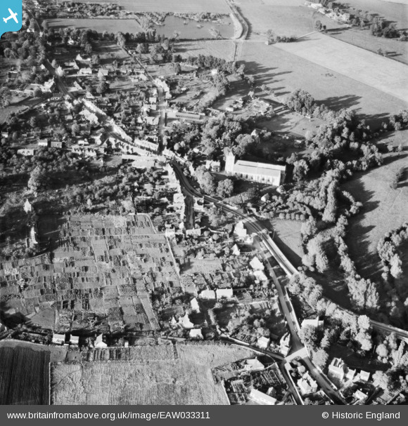
EAW033311 ENGLAND (1950). The Abbey Church of St Peter & St Paul and the village, Dorchester, 1950
© Copyright OpenStreetMap contributors and licensed by the OpenStreetMap Foundation. 2024. Cartography is licensed as CC BY-SA.
Nearby Images (6)
EAW033311

EPW024742

EAW033310

EPW024744

EAW046252

EAW046253

Details
| Title | [EAW033311] The Abbey Church of St Peter & St Paul and the village, Dorchester, 1950 |
| Reference | EAW033311 |
| Date | 5-October-1950 |
| Link | |
| Place name | DORCHESTER |
| Parish | DORCHESTER |
| District | |
| Country | ENGLAND |
| Easting / Northing | 457857, 194136 |
| Longitude / Latitude | -1.1637800078545, 51.642578082285 |
| National Grid Reference | SU579941 |
Pins
Be the first to add a comment to this image!


