
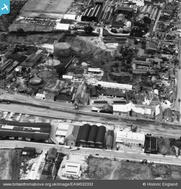
EAW032332 ENGLAND (1950). Frank Pertwee and Sons Ltd Granaries off Hythe Quay, Colchester, 1950
© Copyright OpenStreetMap contributors and licensed by the OpenStreetMap Foundation. 2024. Cartography is licensed as CC BY-SA.
Nearby Images (23)
EAW032332

EAW032317

EAW032319

EAW032329

EAW032333

EAW032328

EAW032320

EAW032316

EAW032324

EAW032318

EAW032325

EAW032331

EAW032335

EAW032327

EAW032334

EAW032321

EAW032323

EAW032322

EAW032326

EAW032330

EPW046368

EPW046371

EPW046370

Details
| Title | [EAW032332] Frank Pertwee and Sons Ltd Granaries off Hythe Quay, Colchester, 1950 |
| Reference | EAW032332 |
| Date | 6-September-1950 |
| Link | |
| Place name | COLCHESTER |
| Parish | |
| District | |
| Country | ENGLAND |
| Easting / Northing | 601470, 224556 |
| Longitude / Latitude | 0.92765529742362, 51.882666475345 |
| National Grid Reference | TM015246 |
Pins
Be the first to add a comment to this image!


