
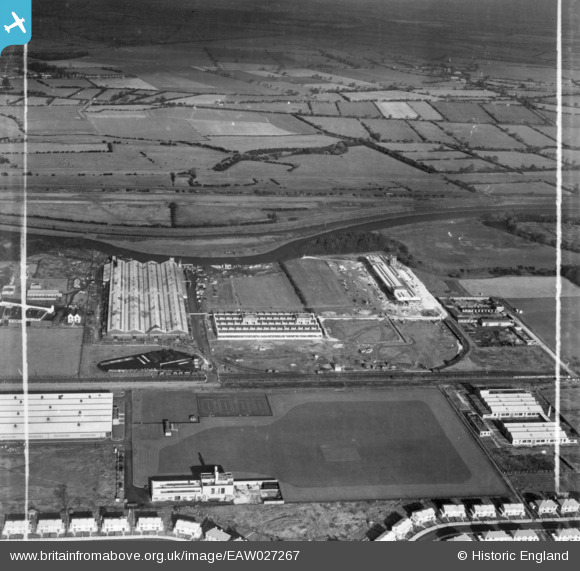
EAW027267 ENGLAND (1949). The International Harvester Factory on Wheatley Hall Road, Doncaster, from the south-west, 1949. This image has been produced from a print marked by Aerofilms Ltd for photo editing.
© Copyright OpenStreetMap contributors and licensed by the OpenStreetMap Foundation. 2024. Cartography is licensed as CC BY-SA.
Nearby Images (17)
EAW027267

EAW038711

EAW027262

EAW027260

EAW027268

EAW038715

EAW027261

EAW027264

EAW027263

EAW038716

EAW038708

EAW038709

EAW038714

EAW038717

EAW038713

EAW027266

EAW038718

Details
| Title | [EAW027267] The International Harvester Factory on Wheatley Hall Road, Doncaster, from the south-west, 1949. This image has been produced from a print marked by Aerofilms Ltd for photo editing. |
| Reference | EAW027267 |
| Date | 19-October-1949 |
| Link | |
| Place name | DONCASTER |
| Parish | |
| District | |
| Country | ENGLAND |
| Easting / Northing | 459341, 405795 |
| Longitude / Latitude | -1.1043513132044, 53.545192060405 |
| National Grid Reference | SE593058 |


