
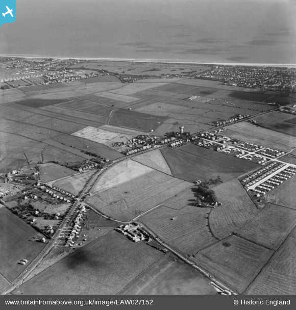
EAW027152 ENGLAND (1949). Burgh Road and the surrounding area, Skegness, 1949
© Copyright OpenStreetMap contributors and licensed by the OpenStreetMap Foundation. 2024. Cartography is licensed as CC BY-SA.
Nearby Images (5)
EAW027152

EAW027151

EAW027153

EAW027155

EAW027162

Details
| Title | [EAW027152] Burgh Road and the surrounding area, Skegness, 1949 |
| Reference | EAW027152 |
| Date | 12-October-1949 |
| Link | |
| Place name | SKEGNESS |
| Parish | SKEGNESS |
| District | |
| Country | ENGLAND |
| Easting / Northing | 555576, 364491 |
| Longitude / Latitude | 0.32692805685598, 53.154503127741 |
| National Grid Reference | TF556645 |
Pins
 redmist |
Wednesday 30th of September 2020 07:41:00 PM | |
redmist |
Wednesday 30th of September 2020 07:40:06 PM | |
shropshiregal |
Saturday 28th of September 2019 11:47:17 AM |


