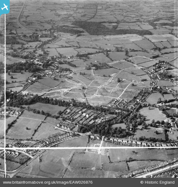
EAW026876 ENGLAND (1949). Henbury Housing Estate under construction, Henbury, 1949. This image was marked by Aerofilms Ltd for photo editing.
© Copyright OpenStreetMap contributors and licensed by the OpenStreetMap Foundation. 2024. Cartography is licensed as CC BY-SA.
Nearby Images (7)
EAW026876

EAW026871

EAW026872

EAW026877

EAW026874

EAW026873
, Henbury, 1949. This image has been produced from a damaged negative.")
EAW026875

Details
| Title | [EAW026876] Henbury Housing Estate under construction, Henbury, 1949. This image was marked by Aerofilms Ltd for photo editing. |
| Reference | EAW026876 |
| Date | 2-October-1949 |
| Link | |
| Place name | HENBURY |
| Parish | |
| District | |
| Country | ENGLAND |
| Easting / Northing | 356949, 178731 |
| Longitude / Latitude | -2.6203529509787, 51.505387184655 |
| National Grid Reference | ST569787 |
Pins
 Buzzard |
Tuesday 27th of October 2015 09:48:09 AM | |
Buzzard |
Tuesday 27th of October 2015 09:47:24 AM | |
Buzzard |
Tuesday 27th of October 2015 09:46:16 AM | |
Buzzard |
Tuesday 27th of October 2015 09:45:05 AM | |
Buzzard |
Tuesday 27th of October 2015 09:44:00 AM | |
Buzzard |
Tuesday 27th of October 2015 09:42:48 AM | |
Buzzard |
Monday 6th of October 2014 06:54:42 PM | |
Buzzard |
Monday 6th of October 2014 06:52:54 PM | |
Buzzard |
Monday 6th of October 2014 06:51:56 PM | |
 Class31 |
Monday 9th of June 2014 10:28:44 AM | |
Class31 |
Monday 9th of June 2014 10:28:00 AM | |
Class31 |
Monday 9th of June 2014 10:16:03 AM |