
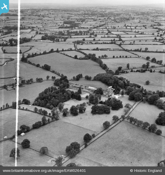
EAW026401 ENGLAND (1949). Fontmell Parva House and surrounding countryside, Fontmell Parva, from the south-east, 1949. This image has been produced from a print marked by Aerofilms Ltd for photo editing.
© Copyright OpenStreetMap contributors and licensed by the OpenStreetMap Foundation. 2024. Cartography is licensed as CC BY-SA.
Nearby Images (5)
EAW026401

EAW026400

EAW026398

EAW026397

EAW026399

Details
| Title | [EAW026401] Fontmell Parva House and surrounding countryside, Fontmell Parva, from the south-east, 1949. This image has been produced from a print marked by Aerofilms Ltd for photo editing. |
| Reference | EAW026401 |
| Date | 8-September-1949 |
| Link | |
| Place name | FONTMELL PARVA |
| Parish | CHILD OKEFORD |
| District | |
| Country | ENGLAND |
| Easting / Northing | 382745, 114352 |
| Longitude / Latitude | -2.245547124643, 50.927812778492 |
| National Grid Reference | ST827144 |
Pins
Be the first to add a comment to this image!


