
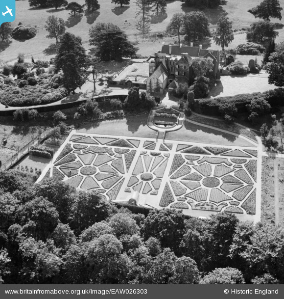
EAW026303 ENGLAND (1949). Pennyhill House, Bagshot, 1949
© Copyright OpenStreetMap contributors and licensed by the OpenStreetMap Foundation. 2024. Cartography is licensed as CC BY-SA.
Nearby Images (11)
EAW026303

EAW026300

EAW026302

EAW037486

EAW037484

EAW026301

EAW037487

EAW037485

EAW037488

EAW037489

EAW037490

Details
| Title | [EAW026303] Pennyhill House, Bagshot, 1949 |
| Reference | EAW026303 |
| Date | 6-September-1949 |
| Link | |
| Place name | BAGSHOT |
| Parish | WINDLESHAM |
| District | |
| Country | ENGLAND |
| Easting / Northing | 489978, 162764 |
| Longitude / Latitude | -0.70763624448924, 51.35631456474 |
| National Grid Reference | SU900628 |
Pins
Be the first to add a comment to this image!


