
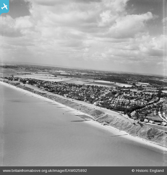
EAW025892 ENGLAND (1949). The Esplanade and town, Frinton-On-Sea, from the east, 1949
© Copyright OpenStreetMap contributors and licensed by the OpenStreetMap Foundation. 2024. Cartography is licensed as CC BY-SA.
Nearby Images (3)
EAW025892

EPW018527

EAW025893

Details
| Title | [EAW025892] The Esplanade and town, Frinton-On-Sea, from the east, 1949 |
| Reference | EAW025892 |
| Date | 10-August-1949 |
| Link | |
| Place name | FRINTON-ON-SEA |
| Parish | FRINTON AND WALTON |
| District | |
| Country | ENGLAND |
| Easting / Northing | 624564, 220274 |
| Longitude / Latitude | 1.2599058352405, 51.83540437836 |
| National Grid Reference | TM246203 |
Pins
 redmist |
Sunday 18th of December 2022 08:25:12 PM |


