
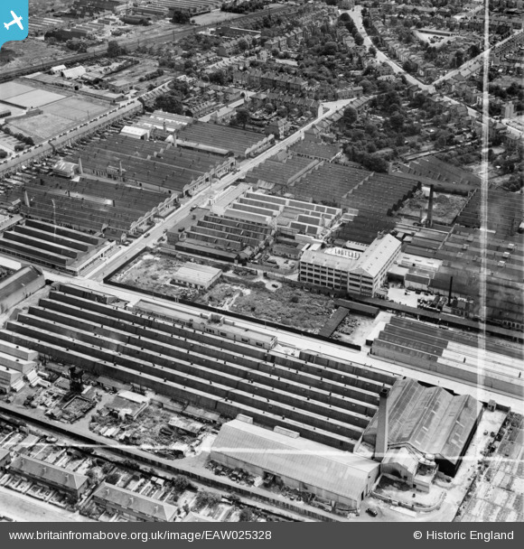
EAW025328 ENGLAND (1949). Factories on the Brantwood Road Industrial Estate, Tottenham, 1949. This image was marked by Aerofilms Ltd for photo editing.
© Copyright OpenStreetMap contributors and licensed by the OpenStreetMap Foundation. 2024. Cartography is licensed as CC BY-SA.
Nearby Images (24)
EAW025328

EAW028108

EAW025329

EAW025327

EAW025331

EAW025330

EAW028540

EAW025324

EAW025323

EAW025325

EAW028543

EAW028538

EAW025332

EAW025326

EAW028107

EAW028541

EAW028539

EAW028545

EAW028104

EAW028109

EAW028544

EAW028106

EAW028105

EAW028542

Details
| Title | [EAW025328] Factories on the Brantwood Road Industrial Estate, Tottenham, 1949. This image was marked by Aerofilms Ltd for photo editing. |
| Reference | EAW025328 |
| Date | 22-July-1949 |
| Link | |
| Place name | TOTTENHAM |
| Parish | |
| District | |
| Country | ENGLAND |
| Easting / Northing | 534592, 191619 |
| Longitude / Latitude | -0.056171182731502, 51.60682788466 |
| National Grid Reference | TQ346916 |
Pins
Be the first to add a comment to this image!


