
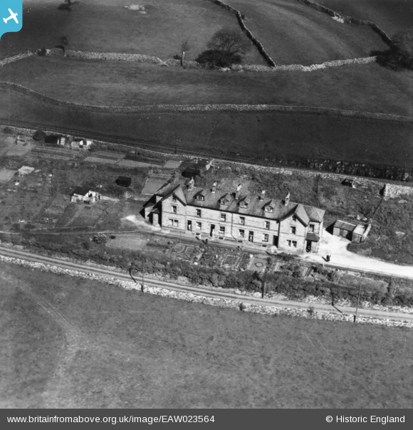
EAW023564 ENGLAND (1949). Ribble Bank, Langcliffe, 1949. This image has been produced from a print.
© Copyright OpenStreetMap contributors and licensed by the OpenStreetMap Foundation. 2024. Cartography is licensed as CC BY-SA.
Details
| Title | [EAW023564] Ribble Bank, Langcliffe, 1949. This image has been produced from a print. |
| Reference | EAW023564 |
| Date | 28-May-1949 |
| Link | |
| Place name | LANGCLIFFE |
| Parish | LANGCLIFFE |
| District | |
| Country | ENGLAND |
| Easting / Northing | 382180, 465719 |
| Longitude / Latitude | -2.2724497009722, 54.086893107726 |
| National Grid Reference | SD822657 |
Pins

User Comment Contributions
 Four out of five doorways occupied by interested housewives and several people along the edge of the gardens. |
 clippedwings |
Saturday 5th of September 2015 10:28:45 PM |


