
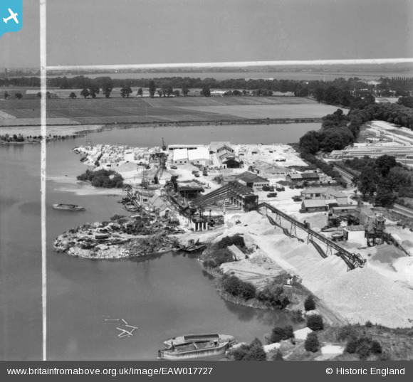
EAW017727 ENGLAND (1948). Aggregates quarrying and processing off Littleton Lane, Shepperton Green, from the south, 1948. This image has been produced from a print marked by Aerofilms Ltd for photo editing.
© Copyright OpenStreetMap contributors and licensed by the OpenStreetMap Foundation. 2024. Cartography is licensed as CC BY-SA.
Nearby Images (14)
EAW017727

EAW017719

EAW017722

EAW018427

EAW017726

EAW017724

EAW017725

EAW018418

EAW018423

EAW017718

EAW053116

EAW017723

EAW018417

EAW018425

Details
| Title | [EAW017727] Aggregates quarrying and processing off Littleton Lane, Shepperton Green, from the south, 1948. This image has been produced from a print marked by Aerofilms Ltd for photo editing. |
| Reference | EAW017727 |
| Date | 29-July-1948 |
| Link | |
| Place name | SHEPPERTON GREEN |
| Parish | |
| District | |
| Country | ENGLAND |
| Easting / Northing | 505847, 167351 |
| Longitude / Latitude | -0.47842116494299, 51.394814156603 |
| National Grid Reference | TQ058674 |
Pins
Be the first to add a comment to this image!


