
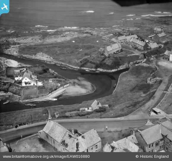
EAW016880 ENGLAND (1948). Seaton Sluice Harbour and St Paul's Church, Seaton Sluice, 1948
© Copyright OpenStreetMap contributors and licensed by the OpenStreetMap Foundation. 2024. Cartography is licensed as CC BY-SA.
Nearby Images (7)
EAW016880

EAW016878

EAW016879

EAW016881

EAW016882

EAW016877

EAW016855

Details
| Title | [EAW016880] Seaton Sluice Harbour and St Paul's Church, Seaton Sluice, 1948 |
| Reference | EAW016880 |
| Date | 24-June-1948 |
| Link | |
| Place name | SEATON SLUICE |
| Parish | SEATON VALLEY |
| District | |
| Country | ENGLAND |
| Easting / Northing | 433724, 576813 |
| Longitude / Latitude | -1.4716380860833, 55.084550075781 |
| National Grid Reference | NZ337768 |
Pins
 Matt Aldred edob.mattaldred.com |
Monday 30th of November 2020 07:04:33 PM | |
 redmist |
Thursday 7th of November 2019 08:59:01 PM |


