
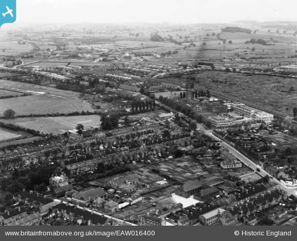
EAW016400 ENGLAND (1948). Sandon Road and environs, Stafford, from the south-west, 1948. This image has been produced from a print.
© Copyright OpenStreetMap contributors and licensed by the OpenStreetMap Foundation. 2024. Cartography is licensed as CC BY-SA.
Nearby Images (7)
EAW016400

EAW016399

EPW034018

EAW016397

EPW053372

EAW016405

EAW016404

Details
| Title | [EAW016400] Sandon Road and environs, Stafford, from the south-west, 1948. This image has been produced from a print. |
| Reference | EAW016400 |
| Date | 9-June-1948 |
| Link | |
| Place name | STAFFORD |
| Parish | |
| District | |
| Country | ENGLAND |
| Easting / Northing | 392210, 324296 |
| Longitude / Latitude | -2.1155973130298, 52.815818142928 |
| National Grid Reference | SJ922243 |
Pins
 Nothing Better To Do |
Wednesday 7th of June 2023 11:00:38 AM | |
Nothing Better To Do |
Wednesday 7th of June 2023 11:00:19 AM | |
Nothing Better To Do |
Wednesday 7th of June 2023 11:00:07 AM |


