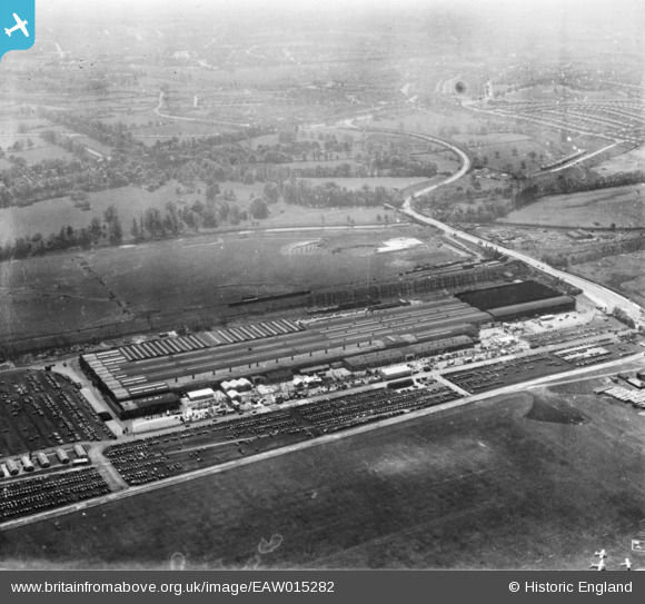
EAW015282 ENGLAND (1948). The British Industries Fair Exhibition Centre, Castle Vale, from the north, 1948. This image has been produced from a print.
© Copyright OpenStreetMap contributors and licensed by the OpenStreetMap Foundation. 2024. Cartography is licensed as CC BY-SA.
Nearby Images (21)
EAW015282

EAW015285

EAW015281

EPW054850

EAW014402
, Castle Vale, 1948. This image has been produced from a damaged negative.")
EAW014404

EPW042881

EAW043036

EPW042880

EAW015277

EAW043039

EAW015279

EPW042879

EAW015276

EAW014403

EAW015286

EPW054851

EAW014405

EAW015278

EAW015283

EAW014401
, Castle Vale, 1948. This image has been produced from a damaged negative.")
Details
| Title | [EAW015282] The British Industries Fair Exhibition Centre, Castle Vale, from the north, 1948. This image has been produced from a print. |
| Reference | EAW015282 |
| Date | 7-May-1948 |
| Link | |
| Place name | CASTLE VALE |
| Parish | |
| District | |
| Country | ENGLAND |
| Easting / Northing | 414167, 290781 |
| Longitude / Latitude | -1.7912146378946, 52.514366100219 |
| National Grid Reference | SP142908 |
Pins
 Billy Turner |
Tuesday 18th of October 2016 07:07:56 PM |