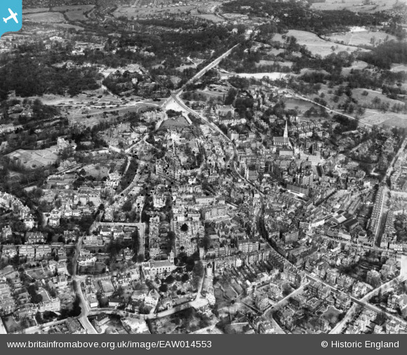
EAW014553 ENGLAND (1948). The Vale of Health, Hampstead, 1948. This image has been produced from a damaged negative.
© Copyright OpenStreetMap contributors and licensed by the OpenStreetMap Foundation. 2024. Cartography is licensed as CC BY-SA.
Nearby Images (17)
EAW014553

EPW056831

EAW000614

EPW056830

EAW000625

EPW057007

EPW056832

EPW057006

EAW015167

EAW014551

EAW015166

EAW000611

EPW056651

EPW056656

EAW000613

EAW015168

EAW000610

Details
| Title | [EAW014553] The Vale of Health, Hampstead, 1948. This image has been produced from a damaged negative. |
| Reference | EAW014553 |
| Date | 15-April-1948 |
| Link | |
| Place name | HAMPSTEAD |
| Parish | |
| District | |
| Country | ENGLAND |
| Easting / Northing | 526295, 185944 |
| Longitude / Latitude | -0.17797385316284, 51.55774444008 |
| National Grid Reference | TQ263859 |
Pins
 Class31 |
Wednesday 20th of August 2014 09:45:00 AM |