
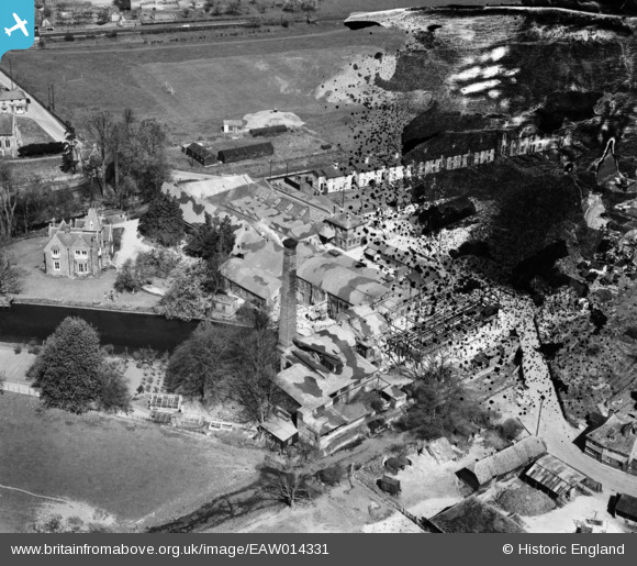
EAW014331 ENGLAND (1948). Chartham Paper Mill, Chartham, 1948. This image has been produced from a damaged negative.
© Copyright OpenStreetMap contributors and licensed by the OpenStreetMap Foundation. 2024. Cartography is licensed as CC BY-SA.
Nearby Images (23)
EAW014331

EAW026261

EAW026258

EAW026256

EAW026260

EAW014329

EAW014325

EAW026262

EAW014332

EAW014333

EAW026264

EAW026257

EAW014326

EAW026263

EAW014330

EAW004715

EAW014328

EAW026259

EAW014327

EAW004718

EAW004716

EAW004717

EPW038131

Details
| Title | [EAW014331] Chartham Paper Mill, Chartham, 1948. This image has been produced from a damaged negative. |
| Reference | EAW014331 |
| Date | 13-April-1948 |
| Link | |
| Place name | CHARTHAM |
| Parish | CHARTHAM |
| District | |
| Country | ENGLAND |
| Easting / Northing | 610787, 154979 |
| Longitude / Latitude | 1.0211072373622, 51.254440337907 |
| National Grid Reference | TR108550 |
Pins
Be the first to add a comment to this image!


