
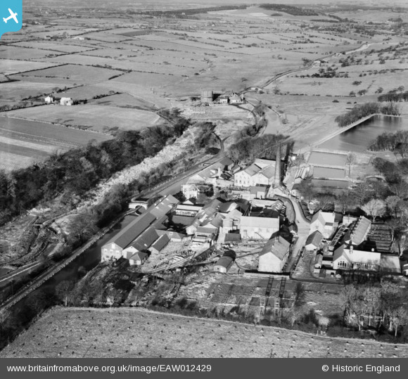
EAW012429 ENGLAND (1947). The Wiggins, Teape and Co Paper Mill, Withnell Fold, 1947
© Copyright OpenStreetMap contributors and licensed by the OpenStreetMap Foundation. 2024. Cartography is licensed as CC BY-SA.
Nearby Images (11)
EAW012429

EAW012428

EAW012425

EAW010390

EAW010161

EAW012427

EAW010159

EAW012426

EAW010388

EAW010160

EAW010389

Details
| Title | [EAW012429] The Wiggins, Teape and Co Paper Mill, Withnell Fold, 1947 |
| Reference | EAW012429 |
| Date | 26-November-1947 |
| Link | |
| Place name | WITHNELL FOLD |
| Parish | WITHNELL |
| District | |
| Country | ENGLAND |
| Easting / Northing | 361119, 423204 |
| Longitude / Latitude | -2.589038245799, 53.703591914196 |
| National Grid Reference | SD611232 |
Pins
 Tim |
Friday 23rd of January 2015 06:05:18 PM |


