
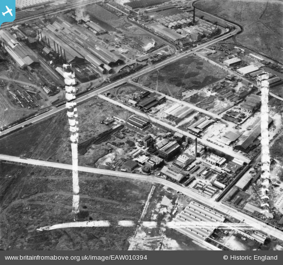
EAW010394 ENGLAND (1947). Industry at Trafford Park including the Geigy Co Ltd Works, Trafford Park, 1947. This image was marked by Aerofilms Ltd for photo editing.
© Copyright OpenStreetMap contributors and licensed by the OpenStreetMap Foundation. 2024. Cartography is licensed as CC BY-SA.
Nearby Images (19)
EAW010394

EAW037560

EAW010398

EAW037564

EAW010391

EAW010395

EAW010393

EAW037557

EAW037559

EAW037562

EAW037556

EAW037561

EAW010397

EAW037563

EAW010396

EAW037566

EAW010392

EAW010399

EPW034851

Details
| Title | [EAW010394] Industry at Trafford Park including the Geigy Co Ltd Works, Trafford Park, 1947. This image was marked by Aerofilms Ltd for photo editing. |
| Reference | EAW010394 |
| Date | 30-August-1947 |
| Link | |
| Place name | TRAFFORD PARK |
| Parish | |
| District | |
| Country | ENGLAND |
| Easting / Northing | 378390, 397333 |
| Longitude / Latitude | -2.3256006233366, 53.472033462631 |
| National Grid Reference | SJ784973 |
Pins
 redmist |
Tuesday 24th of January 2023 11:08:08 PM |


