
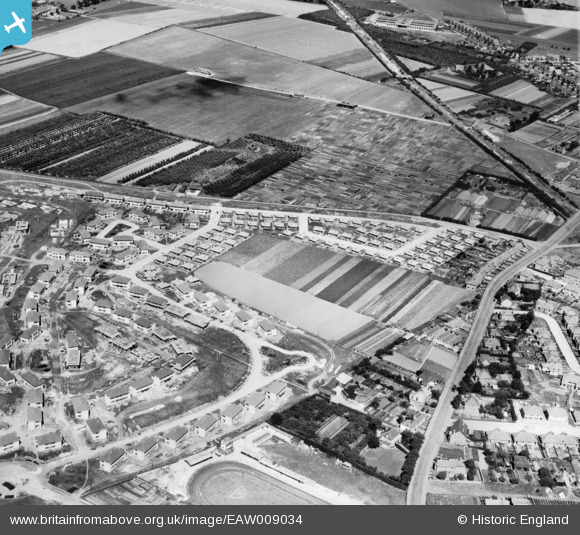
EAW009034 ENGLAND (1947). The residential area at Newington (surrounding Melbourne Avenue) under construction, Ramsgate, 1947
© Copyright OpenStreetMap contributors and licensed by the OpenStreetMap Foundation. 2024. Cartography is licensed as CC BY-SA.
Nearby Images (10)
EAW009034
 under construction, Ramsgate, 1947")
EAW009038
 under construction, Ramsgate, 1947")
EAW009043
 under construction, Ramsgate, 1947")
EAW009042
 under construction, Ramsgate, 1947")
EAW009032
 under construction, Ramsgate, 1947")
EAW009033
 under construction, Ramsgate, 1947")
EAW009037
 under construction, Ramsgate, 1947")
EAW009039
 under construction, Ramsgate, 1947")
EAW009036
 under construction, Ramsgate, 1947")
EAW009035
 under construction and the surrounding area, Ramsgate, 1947")
Details
| Title | [EAW009034] The residential area at Newington (surrounding Melbourne Avenue) under construction, Ramsgate, 1947 |
| Reference | EAW009034 |
| Date | 12-August-1947 |
| Link | |
| Place name | RAMSGATE |
| Parish | RAMSGATE |
| District | |
| Country | ENGLAND |
| Easting / Northing | 636631, 166498 |
| Longitude / Latitude | 1.3984939906261, 51.347709913584 |
| National Grid Reference | TR366665 |
Pins
Be the first to add a comment to this image!


