
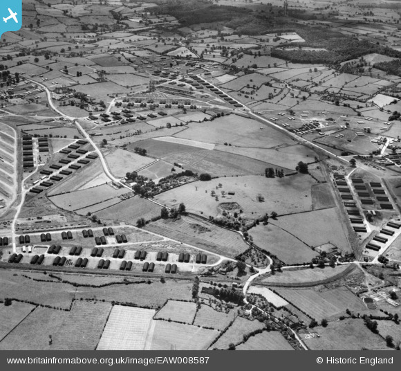
EAW008587 ENGLAND (1947). Marchington Camp, Marchington, 1947
© Copyright OpenStreetMap contributors and licensed by the OpenStreetMap Foundation. 2024. Cartography is licensed as CC BY-SA.
Nearby Images (6)
EAW008587

EAW008588

EAW008589

EAW008585

EAW008584

EAW008586

Details
| Title | [EAW008587] Marchington Camp, Marchington, 1947 |
| Reference | EAW008587 |
| Date | 27-July-1947 |
| Link | |
| Place name | MARCHINGTON |
| Parish | MARCHINGTON |
| District | |
| Country | ENGLAND |
| Easting / Northing | 414083, 330247 |
| Longitude / Latitude | -1.790763156145, 52.869192319877 |
| National Grid Reference | SK141302 |
Pins
 ontheedgeofmaddness |
Tuesday 19th of November 2013 09:44:15 AM |


